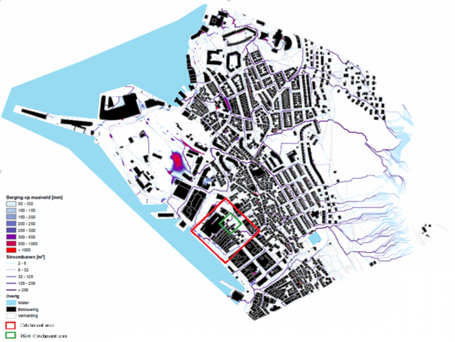
The rist run of a Floodmap Bergen (Bryggen area) is based on the assumption that for a cloud burst the most of the storm water will flow and stay above ground. It visualizes the streamlines and the depth of water in depressions. The quick scan is based on only readily available data. The most important required data is an accurate DEM.
INXCES will provide a new detailed floodmap for the whole city of Bergen soon: with 4 points per square meter and a vertical accuracy of several centimeters which provides an excellent insight in the surface elevation.